HOME
Photographs For Sale
Ephemera For Sale
About Us
Reference Books & Links
More
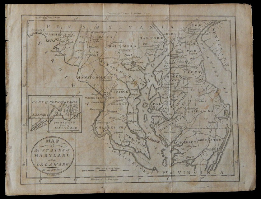
Original 1790 US state area Map the State of Maryland & Delaware By Denison
Original 1837 Map showing the Western States of US 11.5x18.5 By J Olney
Original 1837 Map showing the Southern States of US 11.5x18.5 By J Olney
Original 1837 Map showing the Middle States of US 11.5x18.5 By J Olney
Original 1837 11.5x18.5 Map covering North American / USA By J Olney
Original 1837 Map of the World covering the Globe By J Olney
Original 1837 Map 11.5x18.5 showing the United States of American By J Olney
1885 Mitchell US State 9.25 x 11.5 Map Texas Arkansas & Indian Territory
Original 1883 Colorful US State 11x13 Maps Florida Alabama by Geo F Crams
1883 Crams Colorful US State 13x22 Map Minnesota Territory Dakota North Carolina
Original 1883 Colorful US State 11x13 Maps Iowa Missouri By Geo F Crams
Original 1883 Colorful US State 13x22 Map New York by Geo F Crams
1885 US State colorful 9.25x11.5 Map of Oregon Kansas California & Territory
Original 1790 US state area Map the State of Virginia By Thompson & Andrews
1883 Crams Colorful US State 11x13 Maps Massachusetts Vermont New Hampshire
Original 1883 Colorful US Southern State 11x13 Maps Virginia Kentucky Tennessee
Original 1863 US Civil War 11x9 map Antietam Sharpsburg Defenses
Original 1863 US Civil War 11x9 battle Field topographical map Vicksburg Defense
Original 1863 US Civil War 11x9 map Gettysburg and Vicinity Defenses
Original 1883 Colorful US State 11x13 Maps Louisiana Mississippi by Geo F Crams
Original 1831 Map 9x12 Colorful Northern America Continent and United States
Original 1831 Map Eastern United States -Massachusetts Connecticut New Hampshire
1883 Colorful US State 11x13 Map Railroad County map New Jersey Pennsylvania
Original 1883 Colorful US Southern State 11x13 Maps South Carolina By Geo Crams